 The Edinburgh Tour Guide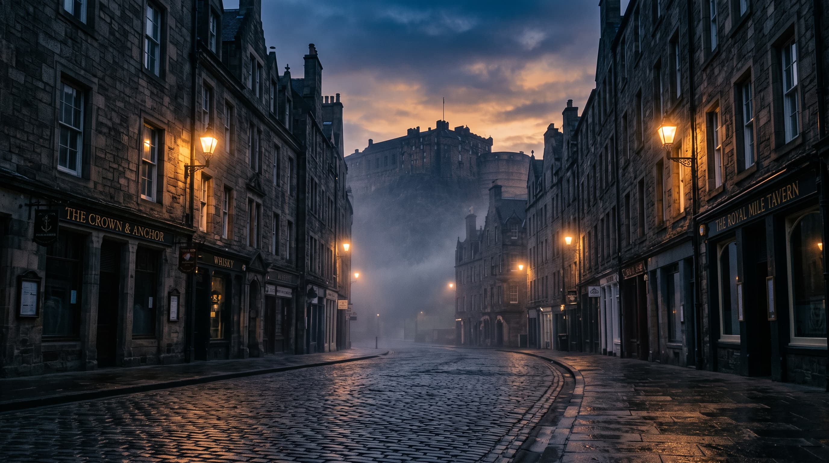
Victoria Street is the most photographed stretch of pavement in Edinburgh that is not a castle. It costs nothing, it takes twenty minutes, and it sits directly between three places you were going anyway. It is also, for about half its length, not called Victoria Street, which is the sort of thing you would expect at least one of the pages ranking above us to mention.
Walk up one side and back along the terrace above it. The curved, colourful half that every photograph shows is West Bow, and the name changes partway up the hill at the Bow Bar. The street was built between 1829 and 1834, three years before there was a Queen Victoria to name it after. Do not make a special trip: route your walk through it instead.
Cost
Nothing
Time needed
20 minutes
Best viewpoint
Victoria Terrace
The half you photograph is not called Victoria Street
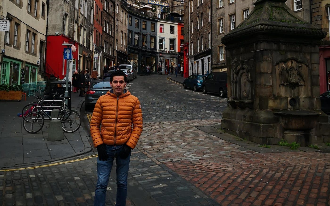
Search for this street and you will get the same photograph a thousand times: the curve, the stacked tenements, the shopfronts in red and teal and mustard. That view is taken from the Grassmarket looking up, and the part of it in frame is West Bow.
West Bow was the original name of the entire route. Gareth Davies, an Edinburgh guide who writes about the Old Town, puts it plainly: the street starts at the eastern end of the Grassmarket as West Bow, and the road changes name halfway up the hill, at the Bow Bar. We are not going to ask you to take a guide's blog on trust, so we checked it against address data on 23 September 2026, and it holds up in four separate ways.
| What we checked | What the address data says |
|---|---|
| Are they two streets? | Yes. West Bow is its own named street (EH1 2JP, EH1 2AW) and Victoria Street is another (EH1 2HE, EH1 2EX) |
| Where does it change? | At the pub everyone uses as the landmark. The Bow Bar has the address 80 West Bow, EH1 2HH |
| Do the numbers run through? | No, and this is the clincher. West Bow runs 80 to 118; Victoria Street starts again at 1 and runs to 42 |
| The well at the bottom | Listed as the West Bow Well, a fountain on the Grassmarket, EH1 2LJ |
Two streets with two independent numbering schemes is not a nickname or a local affectation. The half that made the street famous has a different name from the half that gave it one.
What it was before, and why it bends
The bend is not decorative. Davies's account, which fits what Edinburgh World Heritage records about the period, is that the West Bow was the original main road into Edinburgh for anyone arriving from the north, west or south-west. It zigzagged up the hillside on purpose, because horse-drawn vehicles could not manage the narrow closes that run off the Royal Mile. A zigzag is what you build when you need to get a cart up a hill that steep.
The old route came out at the top by the Butter Tron, the dairy market that stood where Castlehill meets the Lawnmarket. Then, in the 1830s, George IV Bridge was thrown across the Cowgate valley, and the middle section of the West Bow was driven straight through a line of buildings, which were demolished, to meet the north end of the new bridge. The top section, Upper Bow, was closed to traffic, and a steep staircase is all that connects the old thirds now.
The street is older than its name
- Edinburgh World Heritage dates the works to 1829 to 1834, part of a programme of Old Town improvements meant to make the city easier to get around.
- The same page says the street is named after Queen Victoria.
- Victoria did not come to the throne until 1837, three years after the work finished.
- So the name was applied to a street that already existed. That is not a contradiction in the sources, it is just a detail nobody bothers to point out.
Is it worth your time, and what to book
Yes, and no special trip. The street is free, it is open permanently, and it lies on the direct line between the castle, the Grassmarket and Greyfriars. Twenty minutes covers it properly: up one side, back along the terrace. Treat it as the nicest possible way to get from one thing to another rather than as a destination, and it never disappoints. Set aside an afternoon for it and it will.
Nothing sells this street, because you cannot sell a public road. Two bookable things pass through it and both are honest about what they are. We earn a commission on both, which is worth saying on a page whose main advice is that the best thing here costs nothing.

Eating Edinburgh: Old Town Food and Drinks Tour
Three hours, four tastings, twelve people maximum. The only bookable thing we found whose own itinerary lists Victoria Street, alongside the closes and the Royal Mile.

Old Town Highlights Walking Tour (Sandemans)
Covers the Royal Mile, Greyfriars Kirkyard and the Grassmarket at the foot of this hill. Run on the tip model, so the £3.49 is a booking fee and what the guide earns is what you hand over.
A Greek revivalist, told to build Flemish
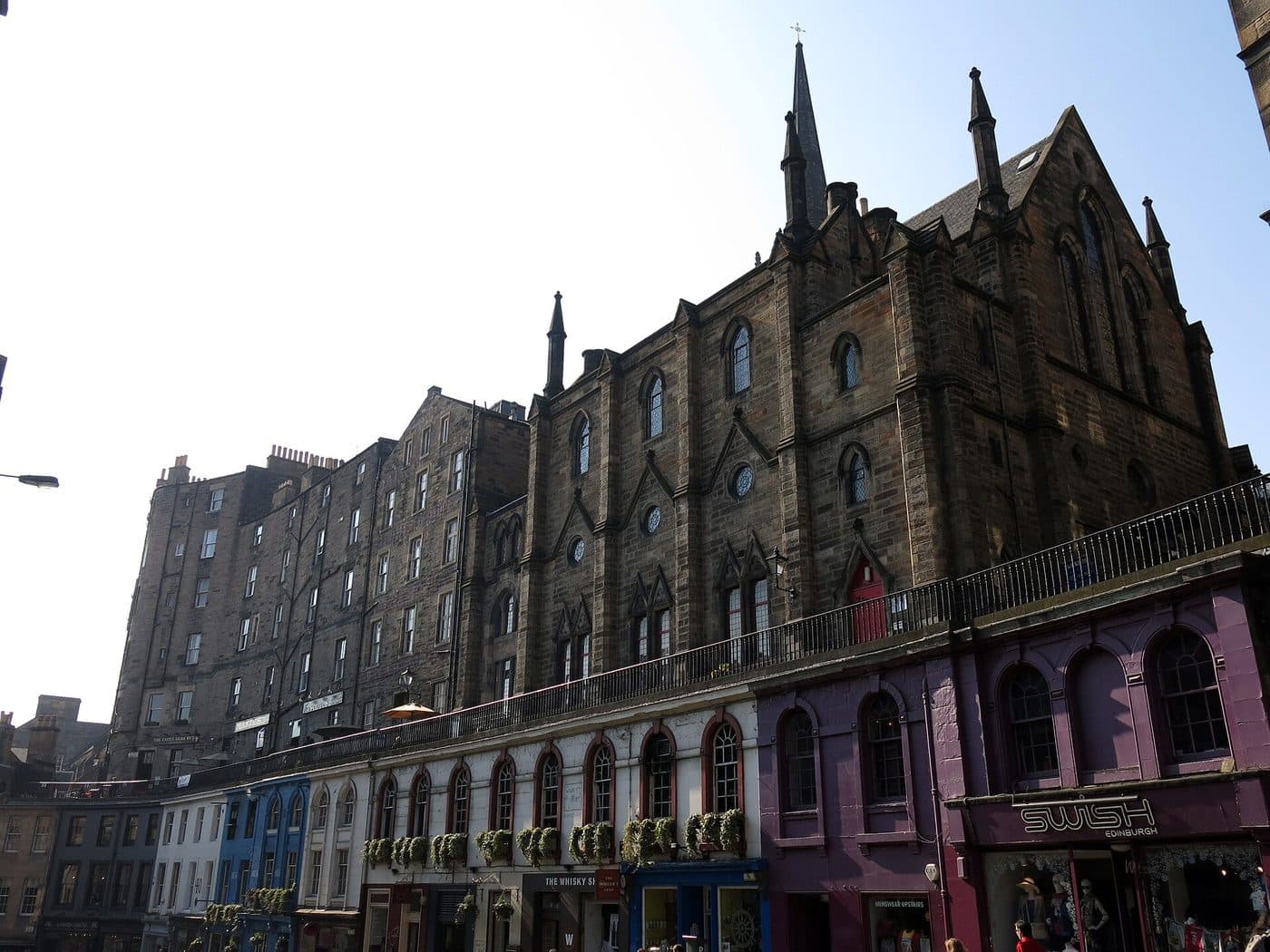
Here is the bit that explains why the street looks like nowhere else in Edinburgh. According to Edinburgh World Heritage, it was designed by Thomas Hamilton, one of the leading figures in giving the city its neo-classical face and a man deeply influenced by the architecture of ancient Greece. And then it was stipulated that the buildings be “Old Flemish” in style, taking their detail from Heriot's Hospital.
So the crow-stepped gables and the stacked, steep, slightly northern-European look you are photographing are not Hamilton's instinct. They are a brief he was handed. It is the only street in the Old Town that reads as a deliberate piece of set design, which is probably why it photographs so well and why it feels subtly unlike the Grassmarket it opens onto.
One building worth actually looking up at is India Buildings, put up in 1864 by David Cousins in the Scots Baronial style. Edinburgh World Heritage points out the bartizan at the top, a little turret borrowed from medieval battlements and doing no defensive work whatsoever. Its first tenants were the British Linen Bank, the Scottish Chamber of Agriculture and the Geological Survey of Scotland, and older Edinburgh residents will remember it as the city's Registry Office.
Where to stand
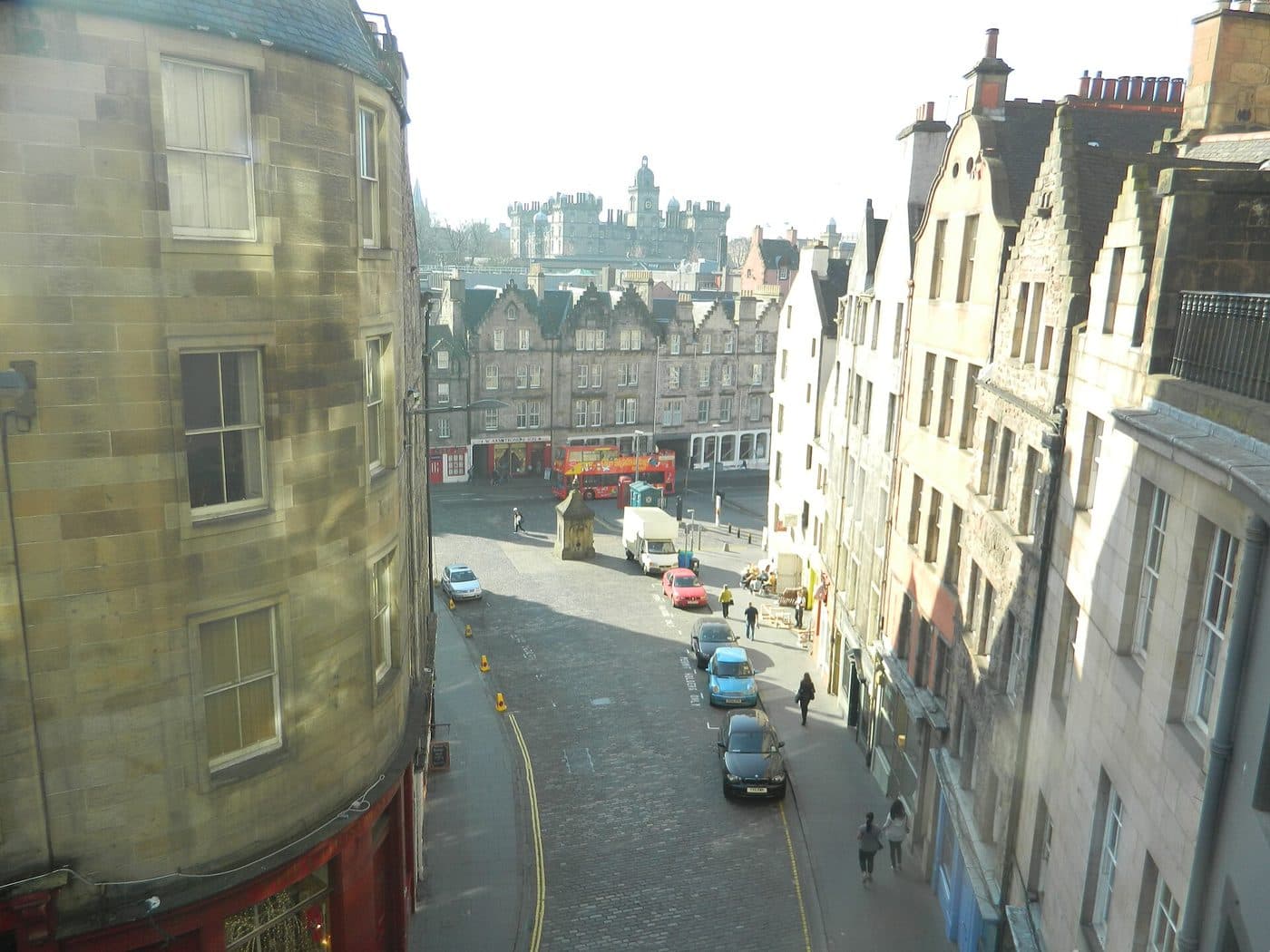
Victoria Terrace is the answer, and most people walking the street never go up to it. It is a pedestrian walkway running above the shops on the north side, a separate right of way with its own postcodes, and it gives you the curve, the rooftops and the Grassmarket beyond in a single frame. You reach it from the steps at either end or from Upper Bow at the top.
The other angle is the one in our own photograph at the top of this page: stand near the West Bow Well at the Grassmarket end and look up the hill. That is the classic shot, and it is the one that is not of Victoria Street.
A practical warning about both. This is a narrow, busy working street on the main pedestrian route between the castle and Greyfriars, and it has a road and parked cars running through it. There is no quiet hour that we can honestly promise you, and we are not going to invent one. Early morning is the usual advice and it is probably right, but we have not stood there with a clipboard at six different times of day, so we are not going to pretend we have counted.
The shops, and why we are not listing them
Every guide to this street publishes a list of shops. We are not going to, and the reason is worth explaining because it applies to everything on this site.
While checking the street names, we pulled the address data for both halves and got 36 named businesses: galleries, a cheesemonger, a whisky shop, tweed and cashmere, a candle maker, an optician, several restaurants and a good deal of gift retail. That data was exactly what we needed to prove where one street becomes the other. What it is not is a register of what is trading today, whether anything has closed, or whether any of it is good. It is volunteer-maintained mapping data, retail on this street turns over fast, and a list written today is wrong within a season.
So: walk it and look, which takes twenty minutes and is the point of the street. But we will give you the one piece of shopping advice we can stand behind, because we already did the work on it. On the Royal Mile page we told you not to buy tartan on the Royal Mile. The answer is two minutes from the bottom of this hill: the Grassmarket Community Project at 86 Candlemaker Row, whose social enterprises include Greyfriars Tartan, described on its own site as an award-winning hand-crafted range. We earn nothing from it, which is rather the point, and the full account is on the Grassmarket page.
One shop we will mention is gone. Edinburgh World Heritage records that the most famous business the street ever had was Robert Cresser's brush shop, opened in 1873 and closed in 2004, barely changed in all that time: a wooden counter, a bare floor, brushes hanging from the ceiling and stacked on shelves, and if they did not have the brush you wanted they would make it. That is what this street used to be, and it is worth knowing while you look at what it is now.
If you want the wizarding angle, it lives on our Harry Potter page, where we go through which claims about this street are documented and which are marketing. And if you are working out where it fits in a trip, how many days you need is the better page for that.
Quick answers
Where is Victoria Street in Edinburgh?
It curves up from the eastern end of the Grassmarket to George IV Bridge, in the Old Town, a couple of minutes below the Royal Mile. It is a public street, free, open all the time, and you will almost certainly walk it by accident on the way between the castle and Greyfriars.
Is Victoria Street actually called West Bow?
The bottom half is. West Bow was the original name of the whole route, and when the street was remodelled in the 1830s the new upper section took the name Victoria Street while the lower part kept its old one. You can check it without taking anybody’s word for it: the Bow Bar, the pub most people use as the landmark for the changeover, has the address 80 West Bow, EH1 2HH. The two halves even number independently, West Bow running from 80 to 118 and Victoria Street from 1 to 42.
When was Victoria Street built?
Edinburgh World Heritage gives 1829 to 1834, as part of a series of Old Town improvements meant to make the city easier to move around. The name came later: Queen Victoria did not come to the throne until 1837, so the street is a few years older than the name on its sign.
What is the best place to photograph Victoria Street?
Victoria Terrace, the pedestrian walkway running above the shops on the north side. It is a separate right of way with its own postcode and it gives you the curve, the rooftops and the Grassmarket beyond in one frame. The other good angle is from the bottom, standing near the West Bow Well on the Grassmarket and looking up, which is the classic shot.
Why do the buildings look Flemish rather than Scottish?
Because that was the instruction. Edinburgh World Heritage records that the street was designed by Thomas Hamilton, one of the leading neo-classical architects of the day and a man steeped in ancient Greek architecture, but that it was stipulated the new buildings be in an Old Flemish style drawing on the details of Heriot’s Hospital. The result is a Greek revivalist working to someone else’s brief, which may be why it looks like nowhere else in the city.
What shops are on Victoria Street?
A mix of independents, galleries, a cheesemonger, a whisky shop, tweed and cashmere, a candle maker and a good deal of gift retail aimed at visitors. We are deliberately not publishing a list, because shop turnover on this street is fast and a list written today is wrong within a season. Walk it and look, and if what you want is tartan that was actually made in Edinburgh, we have a better answer two minutes away.
Is Victoria Street the Diagon Alley street?
It is the street most often pointed at, and we cover that claim properly on our Harry Potter page rather than here, including which shop is which and what is actually documented. This page is about the street itself: who built it, what it was before, and why half of it has a different name.
Is it worth a special trip?
Not a special trip, no, and it does not need one. It sits directly between the castle, the Grassmarket and Greyfriars, so the right move is to route your walk through it rather than set aside time for it. Give it twenty minutes, go up one side and back along Victoria Terrace, and you have had the whole thing.
About this guide
Written by Diego Fresno, Independent travel writer and researcher. The history on this page, including the 1829 to 1834 build, Thomas Hamilton, the Old Flemish stipulation, India Buildings and Robert Cresser's brush shop, comes from Edinburgh World Heritage, read on 23 September 2026. The West Bow account is attributed to Gareth Davies of Edinburgh Expert, a working Edinburgh guide, and was then checked independently against OpenStreetMap address data the same day: the Bow Bar's address at 80 West Bow and the two halves' independent street numbering are the evidence, not the blog. The opening photograph is Diego's own, taken in the Grassmarket in December 2019 and cropped by hand so the caption matches what is in frame. Deliberately not claimed: any shop recommendation, because mapping data is not a trading register and this street's retail turns over fast; which building is the 16th-century one; and any quiet time of day, because we have not measured one. Tour prices and ratings were re-queried from Viator on 22 September 2026. This page carries affiliate links, and its main advice is that the best thing here is free. Verified: August 2026. About the author →